Kommunjakt (borough hunt)

6 08 2023

It started before the pandemic, of that I am sure. My geocaching activities started to slow down both in terms of numbers found but also how often I made the effort to get out and look for them. Of course, I had excuses, none of which were really valid. If I had wanted to go geocaching there was nothing to stop me, not even a global pandemic!

Until 2020 I had a geograpic specific target to ”find at least one cache in a new country”. That got changed for 2021 to be ”find caches in 10 new boroughs (kommuner) in Sweden” as international flying was difficult and something I was actually pleased to avoid after 40+ years of international business travel.

Even so the planned travel activity for 2021 didn’t happen – until now! I should perhaps have made the trip during the heat wave in June but I waited until the continual downpours we had and are having now. We were lucky, I chose a day where we were able to drive away from the rain all the time, so while the neighbours were paddling along flooded street in Gävle we were enjoying good weather.

The route was pretty much fixed, all that was uncertain was if I would do the 950 km journey as a solo day trip or if I would take two days with an overnight stop somewhere if my partner wanted to come with me. She did, even though geocaching is not her thing. Of course, that added several hours to the trip as ”sightseeing” came into the equation.
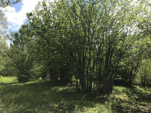
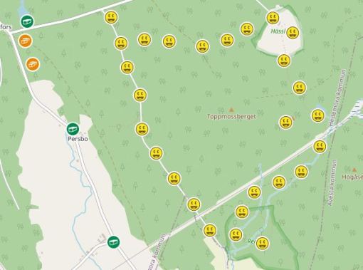
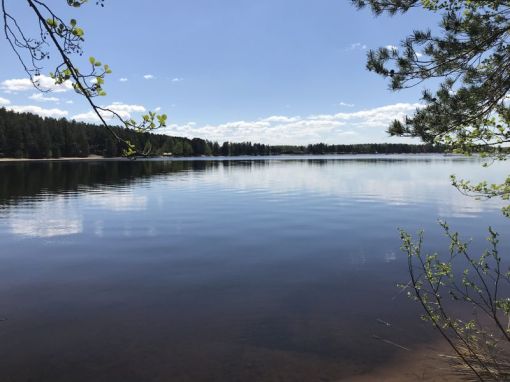
Our route

The plan was to find caches in the boroughs of: Sollefteå, Ragunda, Krokom, Åre and Berg. Sollefteå is in Västernorrland and the other four in Jämtland. Of course I had run a couple of Pocket Queries and chosen caches close to the route and with plenty of favourite points.

Some of the photos below are spoilers so be aware of that.

Just rotate to open!

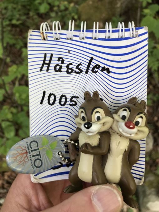
It couldn’t have started better. The first find in Sollefteå was Skoogstokig #Snurrigt. I had no idea what to expect but once on site it was obvious what I needed to do.

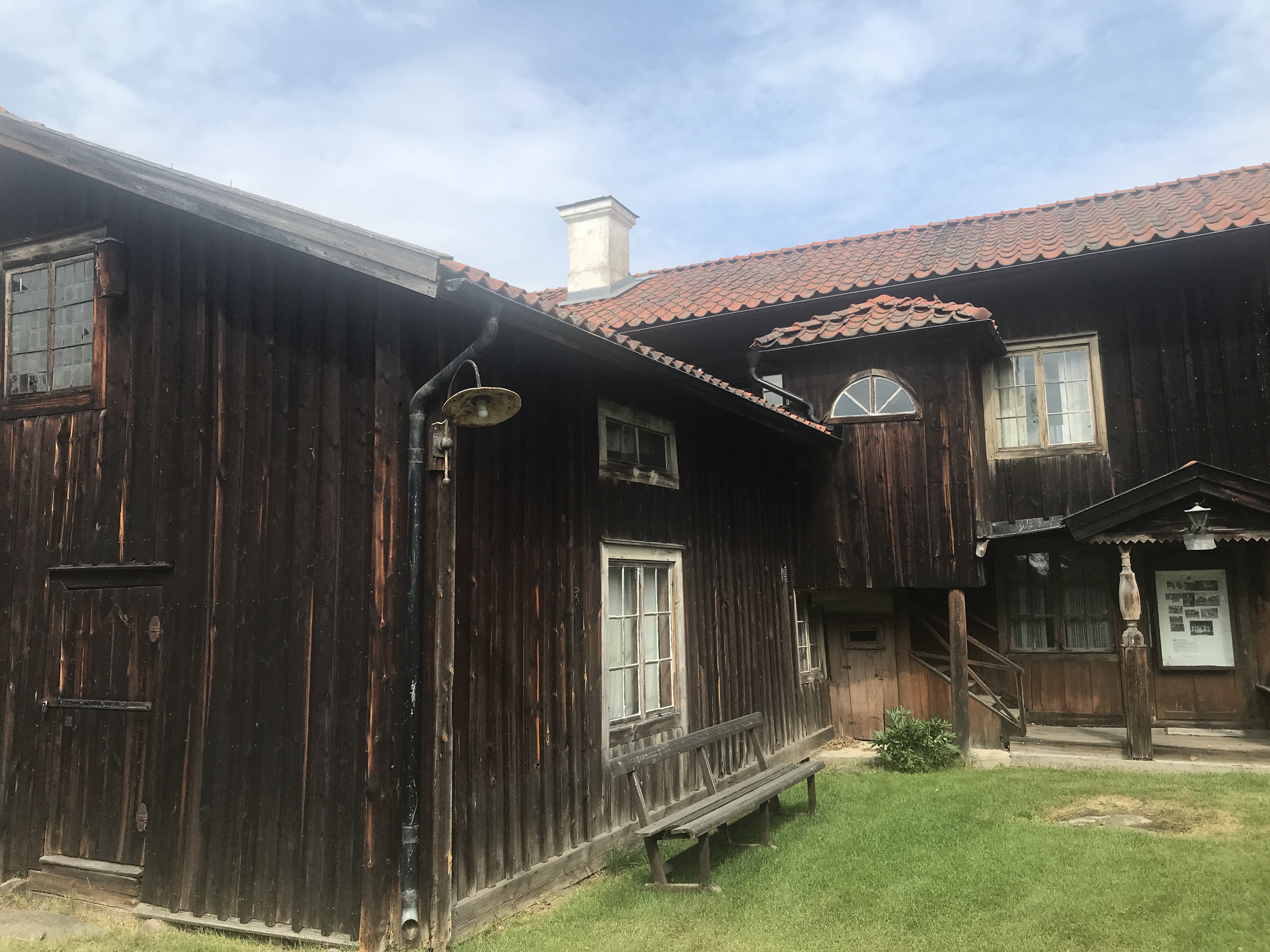
If I was doing a solo trip I would have turned round and headed towards Bispgården and tried to find a few more caches from the same CO. Instead we cariied on into Sollefteå where we had a wander around and a picnic close to Strandpromenaden #11 – Nipstadsfisket. There are still quite a few older buildings in Sollefteå and it’s always great to see the old neon signs.

Old neon sign in Sollefteå

The next stop was in Ragunda or to be more precise, in the vicinity of Bispgården. For me that is the home of the Thai Pavillion which I visited many years ago before geocaching was invented!

Here I made the aquaintance of Roffe Skoogstokig #Peek a Boom.

ROFFE !!


It was so much fun pulling his tail I did it several times.

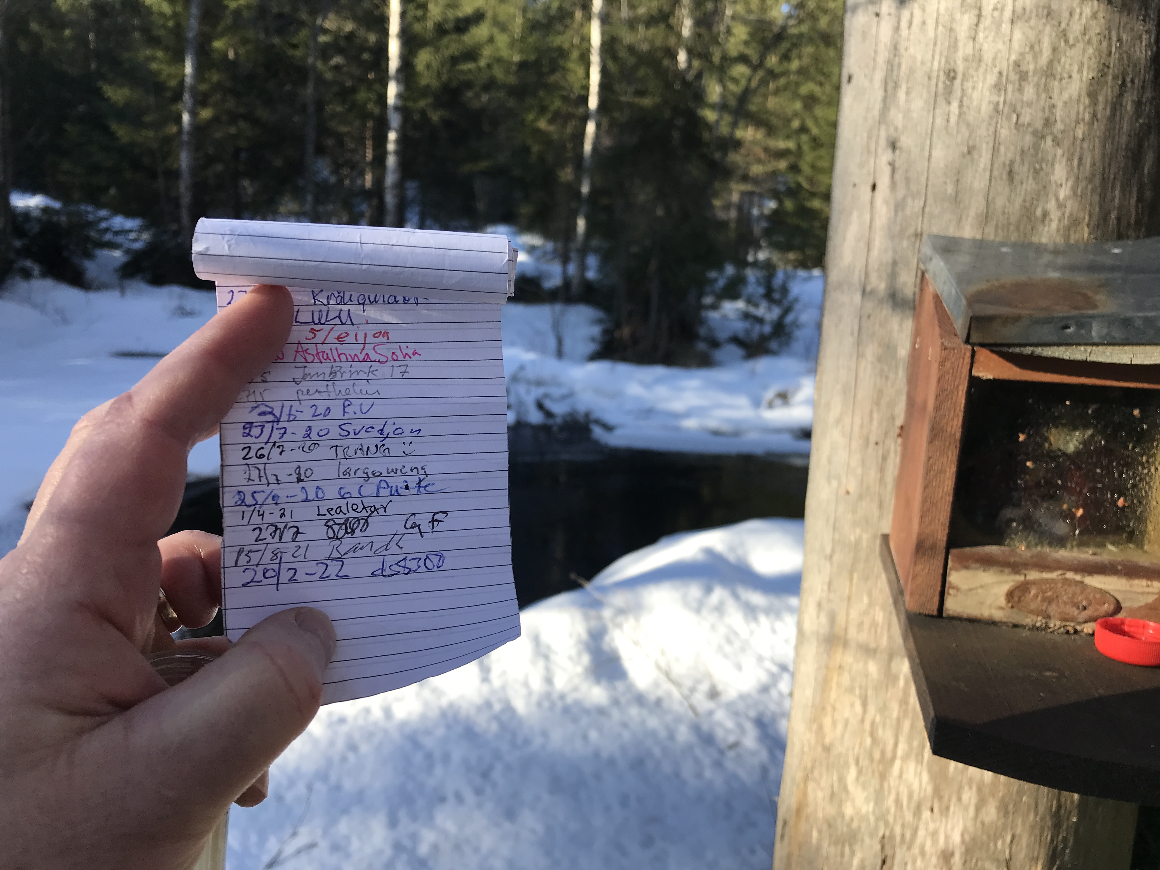
After that it was time to log a find at one of my favourite types of cache container – a bird box. This was better than the average bird box though. Skoogstokig # En holk. I can see that I need to upgrade my artwork on the bird box caches I use.

A pretty neat bird box

Another sign cache was Skoogstokig #9 MMMMM which was a fine piece of engineering.

“Twist and shout” to open

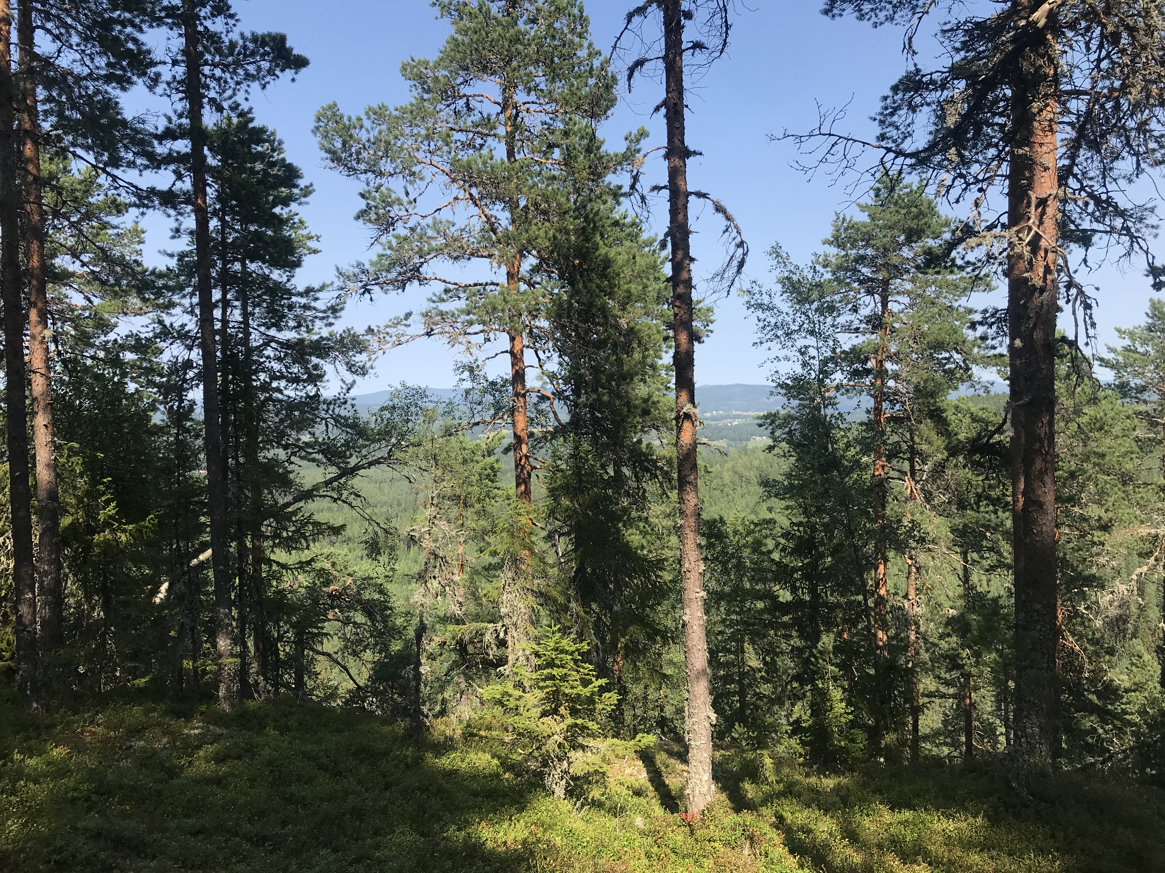
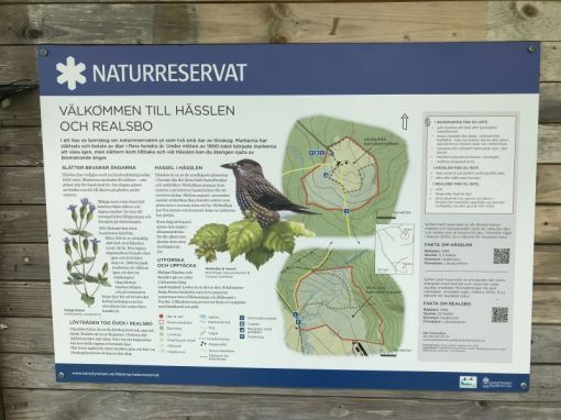
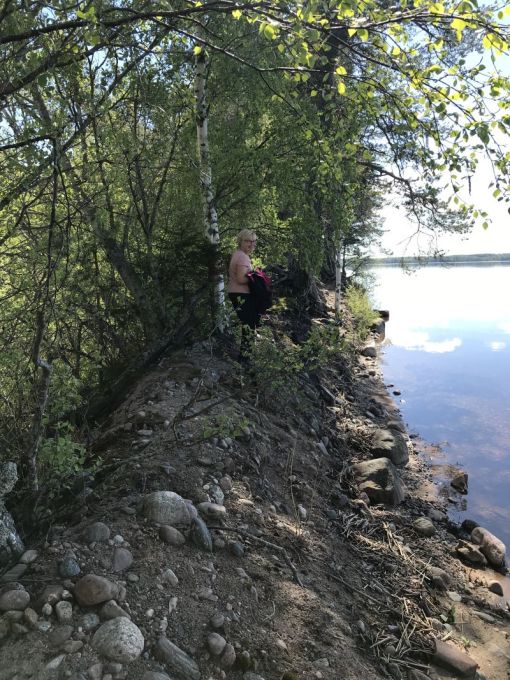
I would have stayed in the area to find more of the CO’s cacher but we were behind schedule so we continued on even though we spent a huge amount of time visiting Wildhussens werk which is a Virtual and as a person interested in geology a fantastic place to stop.

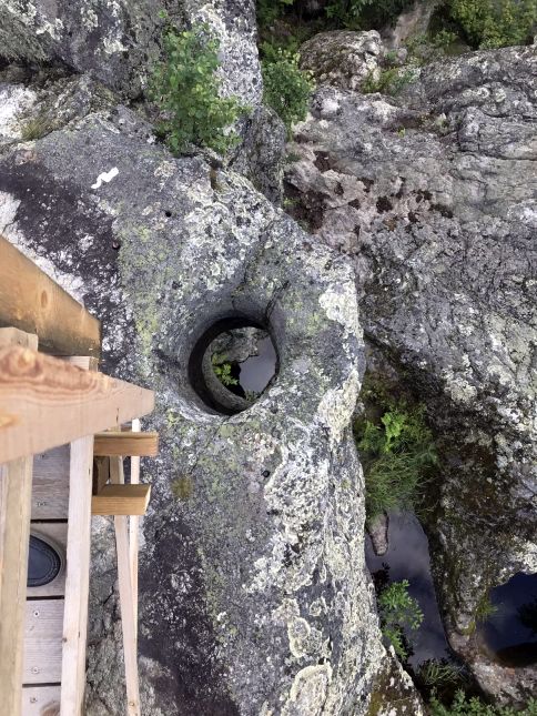
Hole through the rock formed in the ice age

A walk down the dead falls

I always try to stop at Challenge caches Challenge #147 – Alla kommuner i 5 län even though they are often just a PET hanging in a tree. Sometimes there could be something else of interest nearby. Never heard of this company before though.

What do Hallströms do?

I was looking forward to visiting Gamla lanthandeln in Krokom but this was the one day this summer that they closed early so we didn’t get to see the inside and therefore no smiley.

Old country shop in Krokom

Another couple of easy caches were logged before we drove on to Mattmar in Åre Mattmars Kyrka.

Mattmar church bell tower

From there we turned south and headed towards Åsarna where we had booked a room for the night.

In Svenstavik we found E 1194 – Loket som försvann after a few turns around the hiding place.

Buffers in Svenstavik

Here I won’t give a spoiler as this was an cunning hide but not impossible to find. E1194 is actually in Gävle, at the railway museum that is presently closed (still) but due to reopen in a couple of years time.

The evening ended with ordering a pizza and being given an extra one as the baker had made a mistake. Both tasted great!

After a good nights sleep we headed home. No geocaching was planned but we stopped at a few caches on the way.

One cache of note was Macken and the experience was enhanced by a period Cadillac arriving at the same time as us.

Old petrol station

In Bollnäs we decided to make a detour to Söderhamn as there was a cache there that I needed to find to fill an irritating gap in the Jasmer calendar. Stadsparken was nothing special other than when it was placed. It was easier to retrieve than Blåkulla which was placed on the same date.

3-D printed container

The cache was retrieved at around 4 pm on a Friday. The weekend traffic was intense which was great as no-one bothered about me climbing up a post at the side of the road!


Celebration Event and Julottor

20 02 2022

Geocaching in winter is always a little more challenging than during the rest of the year due to the presence of snow. Caches close to the ground are difficult to detect and often if the snow is deep it’s hard work wading through it.

However, events are simpler to prepare or attend and what could be better than a Celebration event just a few hundred metres away from my home? Pulkaåkning och korvgrillning – Celebration Event. It was well visited with attendees from as far away as Gothenburg! As the name suggested downhill tobogganing was expected even if some of the toboggans were rather exotic.

Reindeer toboggan

In addition to the well wrapped-up attendees food was on the menu. Some were happy to eat grilled sausages but others had special hamburgers on their menu!

Celebration Event participants


Gluggfan’s hamburger

Yesterday, (Saturday) the weather forecast for Sunday showed sun and temperatures a few degrees below zero to be followed on Monday with a snowstorm, galeforce winds and up to 30 cm of snow. That gave me the impetus to get out and hunt for a group of caches all with the same theme but placed over a period of several years, Every year since 2015 cgocgo has placed a cache called ”Julotta 20xx”. I have found a couple of them but five were still on my list.

There was virtually no snow in Gävle so I expected that there could be a little more around Rosenbergstugan where Julotta 2020 was placed but not enough to be a problem. The rest of the caches were placed along Militärvägen (I need to find out where it’s name originated) which is usually not ploughed during the winter but not expected to be an issue.

We left road 272 towards Rosenbergstugan on a wide freshly cleared gravel road. When we arrived at the cottage, which is open to the public, we immediately saw that we would not be driving along Militärvägen as there was far too much snow there.

Dilema! Just do the cache at Rosenbergstugan or trudge through snow to the three northerly caches in the series. We chose the latter.

After a walk of about 1km I looked at the map on my smartphone and saw that we had missed a turn off that we should have taken. After a further kilomer I recognised the place where Julotta 2016 was placed. I had found that in March 2017.

We were soon at Julotta 2017 and decided to have our coffe break perched on a couple of nearby boulders that were warmed by the sun.

Unusual trees in Julotta 2017

As expected the cache was a bit more decorated than a usual cache. Worth a favourite point for the artistic content! The next two caches were only a few hundred meters further on along the road but the snow was deeper and more effort was needed to wade through it. Luckily we quickly found Julotta 2021 and again it was something out of the ordinary and in keeping with the theme.

Julotta 2021

The final cache of the day was Julotta 2018 placed close to a running stream. The road there was unploughed and trees had fallen across it so driving up to the cache would not have been possible even with less snow.

Fallen tree

Julotta 2018

The walk back to where the car was parked was along road 272 which was slightlyshorter and much easier going. All in all a great day out. As forecasted the weather on Monday was atrocious so I was glad we had gone out caching on the Sunday.


Nibbleberget

9 09 2021

A record amount of rain in the middle of August (18th – over 100 mm in less than 2 hrs and 162 mm in 24 hrs) resulted in a flooded cellar and frantic activity to remove things, demolish flooring and walls followed by weeks of drying things out. Added to that I discovered a rotten kitchen window frame that I had to repair and the time needed for geocaching just wasn’t there. However, on 8th September we finally had a day off and drove over to Hedemora for some geocaching.

The goal was the trail on Nibbleberget as that combined walking and caching. There are over a thousand caches in the borough and I have been in Hedemora geocaching before but we needed to start somewhere.

We followed the red trail

We parked at the water tower and I rushed over to Vattentornet på Svedjan where I was careless and despite seeing the cache and even taking a photo of it I didn’t realise it was the cache so had my only DNF of the day. I’ll be back.

The geocaching trail more or less followed the red hiking trail around the hill so was around ten kilometers long.

Trail map

It started off with a climb up to the top of the hill Nibbleberget where a fantastic view over Hedemora was to be seen.

View of Hedemora from Nibbleberget

From there on the trail headed back down the hill for a short distance then followed the contour of the hill through varying woodland types that varied from quite overgrown areas to those that had recently been harvested.

Harvested area of forest

When we got to Motionsspår #17 I had to give it a favourite point as it was my find number 8300! Nice number! Somewhere around Motionsspår #19 I looked up, presumably standing at the bottom of the hill in the previous photo and had a great view of blue sky, clouds and pine trees.

Blue sky, clouds and pines

We started out just after noon and some four hours later of which perhaps 20 minutes was spent talking with a couple of local dog owners we met (Balder the little labrador and Rut the Podengo) we were back at the car and the days caching was over.

The caches on the hill before and after our visit

It won’t be long before I will return if for nothing else to grab the cache I DNF’d!


Bollnäs

31 07 2021

It is seldom that I have the opportunity to visit Bollnäs but my partner was meeting up with a friend there so it was a great excuse for me to do some geocaching. It was another hot and sunny day and followed a hot and humid night so I was tired and not really bouncing with energy when I left the station and made my way to Bollnäs church. I had noted that there were a few Adventure Lab caches in Bollnäs and thought I would do one or perhaps more. I can’t really say I like them though. They are like multis with no cache at the end of the trail. I suppose that’s why people are starting to create ALC Bonus caches so there will be a real cache to find.

It was interesting to wander around the graveyard and visit a couple of gravestones associated with the ”ALC. Bollnäs kyrka”. My original intention was to drive up to Bolleberget nature reserve and hunt for the caches there. I had already found two on a previous short visit but wanted to walk over and around the hill. However, after completing the ALC I found the nearby Kämpens.

Bollnäs Hembygdsgård

followed by the ALC bonus Bollnäs kyrka and decided as it was time for coffee I found a bench outside the churchyard where I could eat and drink before doing anything else. I really didn’t feel like anything strenuous so I drove round the corner to Jag rullar which as most Swedes know is the Swedish translation of the latin word ”Volvo”.

Jag rullar!

The cache made me chuckle and was definitely worth all the favourite points it has. From there I carried on to S:t Lars kapell and Slottet i dalen with it’s creepy background history.

By now I was feeling the positive effects of the coffee and decided to drive up to Bolleberget and start the hunt knowing full well that I wouldn’t have time to do them all before we needed to leave for home.

I started with Till minne av Svampbob and wished I had been able to have seen Svampbob Fyrkant at the same location but archived three years ago. A little further along the trail I came across Lappgraven, both the grave and the cache.

Lappgraven

From there it was a short backtrack to where I had parked and STORA BOLLEBERGET #1#.

Kitty

Obviously the cache owner had spent some time creating the cache and the same applied to STORA BOLLEBERGET #12#. Unfortunately the cache was starting to fall apart so I messaged the CO and see that it is now temporarily disabled for maintenance.

Dasset

I only managed to get as far up the hill as STORA BOLLEBERGET #11# before getting a text to say it was time to leave for home.

View from STORA BOLLEBERGET #11#

The view made the walk worth it and as I could take another path down the hill I also found STORA BOLLEBERGET #10#.

I could have found all the caches on the hill if I had gone there directly but now I have another reason on visit Bollnäs. A further reason is to locate all the jigsaw based caches I am now busy solving.


Road trip

6 07 2021

As foreign travel is fraught with too much hassle I have decided to change direction in my geocaching. For several years I have had the aim of adding a new country to the list of those in which I have found caches. It will now be parked at forty eight for the foreseeable future. On the other hand Sweden has 21 counties to explore. I have actually found caches in all 21 counties but only in 179 boroughs meaning that I still have another 111 to go and considering Swedens geographical area it could take some time.

In 2012 I made a one day road trip to parts of Värmland and Örebro län that netted around twenty new boroughs. This time I decided to aim for the closest five boroughs where I needed to find a cache and came up with Vingåker, Finspång, Söderköping, Oxelösund and Gnesta. Google maps indicated it was around 800 km and would take the best part of ten hours without pauses. As it turned out the whole journey was 827 km and took 13:45 according to my GPS tracklog. As I am also a radio ham (remember Tony Hancock or Marve Fleksnes and you’ll get completely the wrong idea) I have an APRS tracker in my car so I can (among other things) see where my car has been (providing I switch my radio on).

DS8300 / SA3ARQ-9 Track log 20210703

So with coffee, food and water packed I set off just after 7 am so I wouldn’t need to worry too much about traffic for a few hours. Apart from a couple of very short pauses just to check something on my phone I arrived at The Big Apple also known as Vingåker, at around 10:30 . Vingåker is known for te Sävstaholm apple. It was good to stretch my legs.

The Big Apple,Vingåker

Just down the road I stopped again for Västra Vingåkers kyrka which was quickly retrieved. I didn’t have time to look at the church or the Hembygdsmuseum.

Museum of local culture, Vingåker

About the same distance again and I was in the centre of Vingåker where I grabbed Nedlagda Postkontor: Vingåker which is now a Coop and today was closed due to a cyber attack with ransomeware as the payload. ICA will be rubbing their hands as that seems to be the only other supermarket in the community.

VingåkerMainStreet

From Vingåker I left Södermanland and crossed over to Östergötaland and the outskirts of Finspång. I was quickly able to grab Finspångsnostalgi Panncentralen. It’s alway fun to visit old repurposed industry sites.

Finspång Old “Panncentral”

Just across the main E51 was a shopping outlet that has also seen better days with an almost deserted car park so grabbing Viberga was a simple operation.

Finspång Viberga shopping centre car park

Fom here I took the E51 and E4 to the Tornby shopping area in Linköping where I had an item to pick up. Once that was done I headed off to Söderköping and the Götakanal. I arrived there at 2 pm just in time to see a boat arrive at the sliding bridge. I knew time was not on my side so I started walking along the canal to pick up …pirum parum …, …kråkan satt…, …på en gren finding them all at good coordinates. So now after five hours I had found nine caches which isn’t a big number of course, but as planned.

Göta Kanal Vennerberga Bridge and boat waiting for it to open

I managed to get through Norrköping despite taking a wrong turn at the weird roundabout by the E22. To go west you need to drive East so I ended up driving right through Norrköping along Södra Promenaden where all the posh houses are. One was featured on a TV program not so long ago.

From there on my next target was Femöre in Oxelösund. I would have liked to visit the old cold war coastal artillery site ”Femörefortet” which is now a museum but I imagine it is pretty much like Arholma and Hemsö which I have visited and in addition I didn’t have time. I did have time to eat my lunch despite it being quarter to four in the afternoon.

Femöre Naturreservat

There were three caches all within a few hundred meters that suited my needs perfectl. I started with Välkommen till Femöre which was just behind me in the photo above. The other two were part of a D-bomb series of caches. Apparently many were released on the same day all over the county in 2017.

Femöre Utsikt from D-bomb #1

Femöre D-bomb #2

Petrol was the next item on the agenda so I pointed my car towards the first petrol sign in Nyköping only to find that their equipment wasn’t working. Luckily I found what I needed and could carry on towards Gnesta, the final borough for the day.

Welcome to Gnesta

It was also where I found two caches that were worth favourit points but for different reasons. Holk de lux was worth a point for it’s construction.

Holk De lux Gnesta. Really great construction

The second cache that got a fvourite point was because of the experience more than the cache itself. As the name suggests Gnesta Bryggeri cache was located near to the old brewery, now an arts centre. The cache was in the car park that was surrounded by a high fence. As I rounded the fence I surprised a woman who was picking flowers. We started talking and I said I was geocaching. Her reply was that she knew where the cache was. After a few hints she admitted that the cache was hers and pointed me to a spot I would probably not have found on my own. Snusmulle was the geocachers name. It’s always great to meet fellow geocachers.

GnestaBryggeri Tricky little blighter

From there it was just the three plus hour drive home to Gävle with a break for food and break just before Hjulsta Bron over Mälaren. All in all a great but tiring day and I found all the caches I had intended to find. Now I have to plan for my next road trip and hopefully it will be more efficient.


Hässlen and Realsbo

5 06 2021

The geocaching trail round a couple of small nature reserves called Hässlen and Realsbo has been on my todo list for a number of years (caches placed in 2015) but it was first now that I got around to actually visiting them.

HässlanNaturreservat

Hässlen and Realsbo nature reserves

Until the end of 2018 I was travelling abroad so often I didn’t have time to do any geocaching and in 2019 other things demanded my attention. Last year and most of this year have been times with very little movement but now the situation has improved.

On the way to Hässlen which lies just to the south of Garpenberg and west of Horndal I stopped at Malmjärn runt 54 and started the day with a DNF. Hmm.

We arrived at Hässlen and parked that car just as a farmer arrived with a trailer load of sheep that were to be put to graze in the reserve.

Får

That meant we couldn’t start to hunt for Berget runt #01. As it was time for coffee we found a suitable place to sit and ate our picnic. If possible on hot days I try to avoid carrying a rucksack. There was no need for extra clothing so we just took water with us and didn’t need a rucksack for that.

We passed through the field of hazel trees and made our way to Berget runt #02. I have never seen such an expanse of hazels before this far north in Sweden. Obviously as we were in a nature reserve we couldn’t pick them, not that there were any visible this early in the year. I’m sure the Nucifraga caryocatactes – spotted nutcracker (Nötkråka) are happy that they are there.

Hasselträd

Hazel trees at Hässlen

Although the trail passed through the usual pine forest it soon changed character and we were surrounded by majestic ash and silver birch trees. They formed part of the Realsbo nature reserve which is just south of Hässlen.

HässlenLövskog

Mighty ashes and silver birches

The next section was along gravel roads then a small MTB track back to the car park. By then we were ready for our second coffe and this time we could sit at the benches and table in the middle of the field near the house.

HässlenÄng

Buildings and meadow at Hässlen

My final cache in the area was Hässlen in which I dropped of a TB. I thought that Chip and Dale (Piff och Puff) would like the access to nuts!

HässlenPiffOPuff

Chip and Dale moving in to Hässlen

Once that was done I calculated the coords for https://coord.info/GC5R8JP Berget runt bonus which we found on our way back to the car.

Hässlen_Berget_runt_Done

Found geocaches

I had one more cache to find and that was Challenge#Logga 20 Svenska kommuner på ett dygn.
I met the requirements in 2012 but this was the first time I was close enough to the cache to log the find.

All in all a great day.

Dagens statistik
Caching: 30 icon_smile | 1 bluey | 1 📝
Körde: 211 km
Gick: 8,8 km
Vädret: +20-22° ☀️


Årsunda

28 05 2021

Winter is usually a time when my geocaching activities are either super high (trip to New Zealand for a month or so) or super low (stay at home in Sweden). This year due to the pandemic I had no choice but to stay home and as a consequence my find count at the end of March was three, yes t h r e e caches.

Now at the end of May things have started to look up but my activity level is still lower than usual. I blame it on the weather, or more likely the lethargy that a pandemic brings on you when you don’t really have the same freedom of movement everywhere that you are used to. I know, excuses. Just do it.

So I did. Bought a new GPS that is. My existing GPS is a Garmin Oregon 450 which I have had for several years now and it’s age was showing. The rubber cover on the on/off switch had gone and the touch screen was badly scratched. Otherwise it works perfectly and is a convenient size for my pocket. I have looked at a Garmin GPSMAP 64 series GPS since they came out but as I had a working GPS there was no reason to buy one. The larger size and smaller screen put me off a little. I remember the buttons on the Garmin eTrex GPSr’s that I have owned and found the touch screen to be convenient – most of the time. It didn’t like me wearing gloves and as mentioned above the protective layer soon wore off. I needed to find a replacement and after looking at the models that Garmin now has my choice finally fell on the GPSMAP 65s. I nearly sent it back as I felt that the screen was too small, but after using it I really liked the accuracy it has even under tree cover. I use my iPhone if I need to see satellite images of the area I am in and for logging in the field.

Oregon450vsGPSMAP65s

Garmin Oregon 450 & GPSMAP 65s

I have also learnt about the existence of Garmin Explore and the improved Basecamp software. I installed Basecamp a few years ago then removed it as the older and simpler Mapsource was more useful for what I needed to do. Let’s see if Basecamp has more to offer me this time. I see that I can sync the contents of my GPS with a Garmin site so that it can be shared and also saved on my phone. Again, I don’t see any need for this functionaility right now but something may turn up in the future.

So of course, I just grabbed the GPS, stuck in batteries and loaded the relevant OSM map and a .gpx file of geocaches around Årsunda and took it with me for a few hours of geocaching. No need to wonder how the thing worked, it just did.

When we got to Strandbaden in Årsunda it was time for our picnic which we ate sitting at a table near the campsite. This is where the difference between online and offline caching showed up. I had downloaded a relatively old pocket query imported into GSAK which I still find to be the best geocaching tool ever and transferred that to my GPS. My GPS showed Strandbaden to be just a few meters from where we were sitting but my phone with it’s simple geocaching app showed it to be over towards a little red building a hundred meters away. From experience I know that the online data is usually the latest so I didn’t even bother to look for the cache based on the GPS reading.

Strandbaden

Strandbaden

We then started to follow the beach around to Åshuvudet stopping first at Grillplats. My GPS sent me to a three trunked tree (the one to the left of the photo) several meters from the roofed grill area. Nothing.

Grillplats

Grillplats

A message was sent to SE81293 as he was the last to find the cache and only then with the help of a lifeline, but before we got a reply we had moved on to Tärnbräck2 and Tärnbräck.

Tärnbräck2

View from Tärnbräck 2

Tärnbräck2 was a simple find and the coordinates were fine. Tärnbräck on the other hand was way off. The coordinates I got were included in my log. I’m pretty sure that they are far more accurate than the ones posted.

The path out to Åshuvudet 3 and the other two caches we found before getting to the end of the peninsular was great fun especially when the peninsular narrowed down to being just over a meter wide.

Åshuvud3

Åshuvudet 3

We arrived back at ”Grillplats” after receiving a message from SE81293 with information on where to search for the cache. It was a good eight meters from the tree high up under the rof of the grill. Not unexpected of course, but not at the coordinates given.

This is where it doesn’t matter if you have a commercial grade GPS costing thousands that is garanteed to put you within a centimeter of a spot on the earth when the person posting coordinates, in this case a geocacher, has a piece of equipment that is not at all that accurate. Mobile phones of anything but the latest generation seem to come into that category. Nevermind, it’s part of the experience.

From Årsunda we drove over to Gammelstilla Bruk via Snart hemma? My cache at Gammelstilla is still in place after nine years so I’m happy with that. The day ended with a visit to Torsåkers Pelargonmuseum och Trädgård and the purchase of a couple of English geraniums – what else?

Dagens statistik
Caching: 8 
Körde: 114 km
Gick: 7,8 km
Vädret: +20-22°
☀️


A milestone

9 12 2020

It was in a random chat with a couple of my geocaching friends, Gustafs Liza and X_1, that the thought of doing something different with cache finds statistics turned up. It was ages since I had managed to fill the ”Find a cache by cache date” grid and I had wondered about some new targets. Our chat was in February at an event they had arranged, before the world stood still. I jokingly asked Liza if they were arranging so many events in order to fill an ”event by date” matrix and the answer was yes! When I got home I fired up GSAK and split my Found statistics into Finds for trads, multis, mysts and events.

I found that I had six missing dates for the Trads! Doable with no real effort on my part except that the last date in the calendar was 8th December. When it came to the other categories the situation was not so good. I needed to find 63 mysts, 236 multis and 290 events on empty dates to tick off those targets as done.

Anyway, yesterday was the 8th December and I remembered to get out and find a trad!

Found trads by find date

My next task will be to see how far I have advanced with the other types of caches and start to formulate my goals for 2021. One of the goals will disappear and that is to find a cache in a new country. Travel isn’t on the agenda for the foreseable future.


Ångersjön

27 11 2020

I discovered this trail just over a month ago when I was finding caches on Vallarundan. I don’t fully remember the circumstances. I think I checked Kent Wallin’s profile as he was the owner of the Vallarundan BONUS cache and saw that he had been on this trail just a couple of days before I was walking round the Vallrundan trail. I do remember thinking that I should have been here at that time as I ended up with a whole bunch of DNF’s on that trail.

Anyway, a new trip to Söderhamn was already planned for sometime in November so I just kept my fingers crossed that the weather would stay fine and that winter snowstorms would wait until December. I checked the forecast before leaving Gävle and 9°C in Söderhamn was shown. None the less I put an extra fleece in the car just in case. After leaving my partner in Söderhamn I continued up the E4 to Ångersjön. As I approached fog shrouded the forests and the temperature quickly sank to just +1°C. I was glad to have brought the fleece with me.

It was then just a case of following the trail starting off with an older cache Ångersjön which was a regular cache hidden conveniently near a table and benches. I noticed that there was ice on the lake. Brr!

Start of the Ångersjön runt trail

I was in a good mood as I approached Ångersjön runt #1 but that quickly changed after about twenty minutes of fruitless searching for the cache. Trails usually consist of the same type of container and I know that once the first one is found that it is usually easier to find the rest. At least the beach wasn’t crowded so noone saw me wandering around.

Ångersjön beach

I gave up and went on to the second cache and here I was quickly rewarded with a continer that met my expectations of what I would be looking for on the trail. The snow in the field made me wonder what the trail would be like.

Winter is coming

I quickly found out. Snow and ice on parts of the path and some slippery stones. The worst part was a bridge over a ditch made of wooden pallets that were covered in a layer of ice. I made it over without slipping into the water but only just!

Anyway, this is an example of the cache I was looking for. Not really a spoiler as this type of container is everywhere on trails these days. The way the log strip was attached was new. Must be some special hospital tape!

Spruce and PET-preform

From time to time I had a glimpse of the lake but as it was such a grey day it didn’t really matter that I didn’t see so much.

Too cold for a swim

The caches, with one exception were at pretty good coordinates so finding them was straightforward. Cache #6 was on the opposite side of the road to where both my Garmin GPS and my phone GPS pointed me, but that’s not unusual on this kind of trail so I found the cache quite quickly anyway. The road was covered in snow but the path in the forest was mostly clear once I got to the south end of the lake.

Snow covered forest road

There was a new stream to cross but this time there was no need to walk on icy boards. It was narrow enough at one point to stride over. The sound of running water was about all that could be heard once I got away from the E4 side of the lake.

Ångersjön beck

Once I had reached #9 there were no more forest paths. It was now icy gravel roads up to past #14 then a proper asphalted road. As I approached #12 I saw a strange post sticking up through the trees. A couple of minnutes later I realised what it and the others that appeared after it were. They belonged to the old dismantled railway that ran north from Söderhamn. I have travelled north by train when it was still in operation but that was a long time ago. I also recognised the old E4 that I have driven on several times on my several trips to Hudiksvall last century!

Track of old railway

The rest of the trail was straightforward except that I messed up getting the right answer to the bonus cache. I thougt I should separate the words with commas but they should have been full stops! Duh! I got an answer from the CO pointing out my error later in the day when I was home again.

At least the coffee and sandwich still tasted great after the trail.

Coffee and sandwiches are next on the agenda

Oh, and what about #1 that I DNF’ed on? I drove round to it and found it straight away exactly where the GPS pointed. What did it look like? You guessed it! So I ended up finding all the caches and have the coords for the bonus cache ready for my next trip north.

Ångersjön runt smilies


Skatön

20 08 2020

August 20th
Today, my partner was going to visit a friend in Söderhamn, a small coastal town some 90 km north of Gävle. It’s two main landmarks are a white tower (Oscarsborg) on top of the eastern hill and a white water tower on the western hill. A hill that once housed a secret railway tunnel but that’s another story.

My goal for today was to visit the nature reserve called Skatön (Magpie Island if translated literally) some 10 kilometers to the north east of the town centre. There are over a dozen caches there and the area seemed ideal for a visit. Skatön #1 was the first in a series of nine trads that culminated in a myst.

A fairly hot day was promised but as it was cold when I got to the car park I took my jacket but left my rucksack in the car. I could have taken my coffee and sandwich with me but carrying a rucksack when foraging around in trees looking for geocaches is not too practical so I had a fortifying cup of coffee and sandwich before I started the trek over the footbridge and onto the island.

The first few caches were along a reasonably wide and well maintained forest track that was free from roots and other obstacles. The first cache on a trail usually sets the scene for the type of container to look for. In this case it was the ubiquitous PET-preform. I didn’t notice when I got to Skatön #4 that the terrain rating was 4.0 but I have to admit that it was a kind rating and no great effort was needed to retrieve the cache despite it’s elevated position,

After the first five caches in the series it was time to hunt for an older cache Scoutön and that was found quickly in a largeer container than the ones I had just found. It was in a small bay that stank of rotting seaweed so I was pleased to move on and back to the Skatön series.

Scoutön cache

The track moved over to the northern side of the island and soon I was on a bery stoney beach, where people had made various patterns with the stones. There was a huge glacial erratic very close to the coordinates for Skatön #7 but I soon realised that tree climbing was involved. A couple of years ago I had my shoulder operated on so lifting and climbing have been somewhat limited since then. This was the first larger tree I climbed in since then and it was not too difficult. I didn’t spot the cache until I had given up hope and was on my way down the tree again. I had been behind my back on the climb up.

North side of Skatön


View from above Skatön #7

From there on there on the track was stoney for a distance then went back to being a forest track.

Between Skatön #7 & Skatön #8

As I approached the small pond where the final cache in the series was placed I noted a small toad making it’s way over the track.

Caution – toad crossing

I had collected all the letters in the cache containers and put them into Certitude and got a red cross for my efforts. The same happened again on the second attempt. It was only when I got home and contacted the owner that I saw I it was a simple anagram that needed to be solved. Too late though as I had left the area.

There were two caches on the eastern side of the island that were placed by Bisko and took me as far out on the island as was possible. On the return walk I met a couple of guys on their way out to the tip of the island but they were clearly not geocachers.

The sun glistened on all the spiders webs in the sea of blueberries and lingonberries I passed by on my way back westwards.

Sun glistening in spider’s webs

Just to round off the day I walked to the western side of the island and visited Skatön hill. Although it isn’t that high above the rest of the island the north side has quite a steep drop off to the sea. Not a place for night caching.

All in all I had a pleasant couple of hours walking and geocaching spiced up with an easy climb.